
After our sensory overload at Pictured Rocks National Lakeshore, we continued east across the Upper Peninsula to the Straits of Mackinac. There we camped at the aptly named Straits State Park, visited Mackinac Island, and left the UP by way of the Mackinac Bridge.
Probably the first thing to establish is that “Mackinac” is pronounced just like “Mackinaw,” with a “naw” at the end, not a “nack”. It all has to do the French attempts to interpret and pronounce the early Ojibwa names for the island and the area. Yes, it is confusing.
Because of its strategic location in the straits between Lake Huron and Lake Michigan, the British built a fort on the island in 1780. The U.S. took possession of the island in 1783, relinquished it back to the Brits during the War of 1812, and regained it again in 1815.
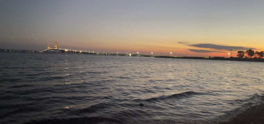
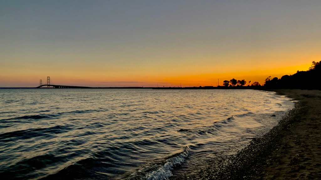
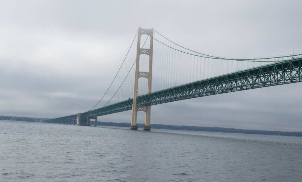
Our campsite at Straits SP was right on Lake Huron and we had a great view of the Mackinac Bridge. Coming as we were from the Chesapeake Bay and its Bay Bridge, it was sort of comforting to see a big long bridge. We were quite envious to realize that the bridge is lit up with colorful lights at night. Too bad the Bay Bridge doesn’t do that. The next morning we drove to St Ignace to ferry over to Mackinac Island. We passed right under the bridge and got a good look at it.
Mackinac Island is quite a place. It is historic yet colorful, old and also very touristy. At one time (1875 to 1895) it was actually America’s second national park, after Yellowstone. In those days the island was very popular as a summer resort and with some pushing by a Michigan senator from the island, President Ulysses S. Grant made it a national park. The island was then split between the national park, Fort Mackinac, and privately owned land. Federal troops stationed at the fort ran the park with no federal funding provided for the upkeep of the park. When the fort was decommissioned and the troops were moved away, the state of Michigan requested the park be turned over to the state, creating Mackinac Island State Park, the first state park in Michigan. The park now encompasses about 80% of the island, including the fort and the historic downtown area.

We took the ferry from St Ignace over to the Island, about a twenty minute ride on a beautiful day. We sat on the top deck and had a great view of the harbor and the approach to the island.

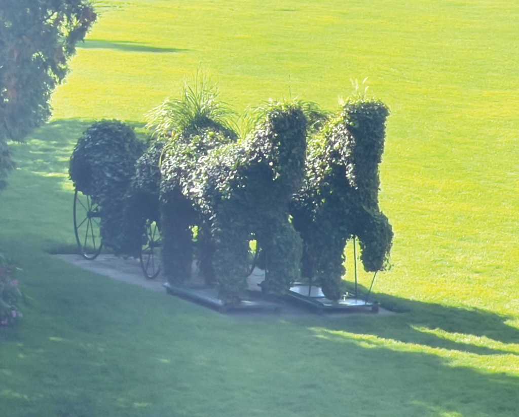
As you approach the dock, you notice several bike rental spots, reminding you that there are no motor vehicles allowed on the island, except for emergency vehicles, service vehicles, and snowmobiles in the winter. Bicycles are everywhere, along with horse-drawn carriages full of tourists.
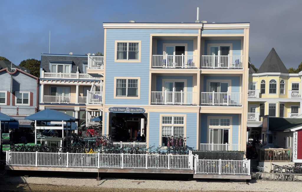
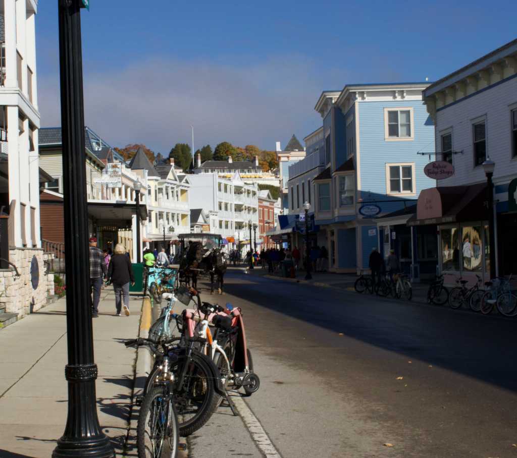
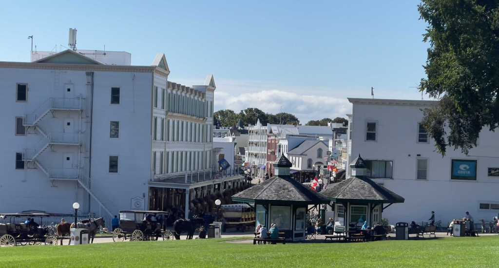
Main Street greets you once off the ferry and is lined with all types of touristy shops filled with those folks that took the ferries before you. Art galleries, clothing stores, souvenir shops, and the island’s famous fudge stores beckon you in. Known in some circles as the Fudge Capital of the World, the island has seven fudge businesses with thirteen shops scattered about.
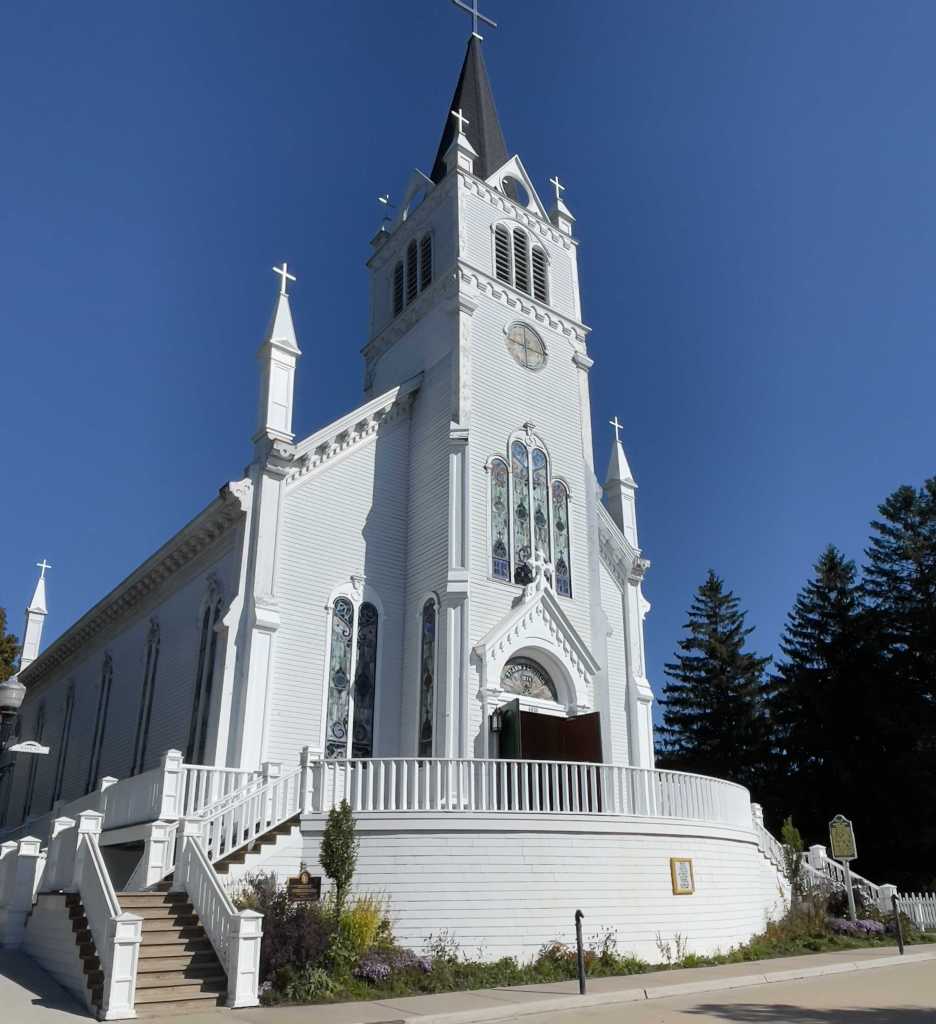
There are also many great old buildings on the island. Sainte Anne Church is a Roman Catholic church constructed beginning in 1874. It was recognized in 1992 as a registered Michigan historic site, and is one of the oldest Roman Catholic parishes in the interior of North America.
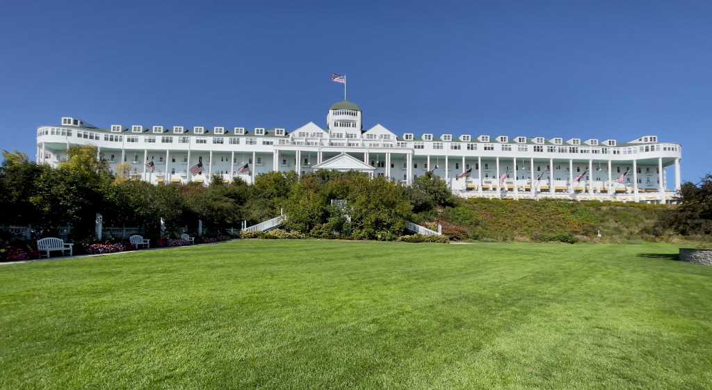
The island is in part dominated by the Grand Hotel, on the hill overlooking the harbor and the city. The massive front porch is the longest in the world at over 660 feet in length, and looks out over the massive swimming pool and the manicured lawns.
The hotel, built right after the island was named a national park, is considered one of the best in the world by many travel experts. Five sitting U.S.presidents have visited, and the porch was the site of the first public demonstration of Thomas Edison’s phonograph. It has been prominently featured in two movies, including “Somewhere in Time”. It is a National Historic Landmark.
Also perched on the hill over the city and harbor is Fort Mackinac. Fort Mac is a former British and American fort, active from the late 18th century to the late 19th century. The British built it during the American Revolution to try to control the very strategic passage between Lake Michigan and Lake Huron. The location of the fort also enabled control of the lucrative fur trade on the Great Lakes. Even with the outcome of the Revolutionary War, the fort didn’t come into American hands until thirteen years after the end of the war.
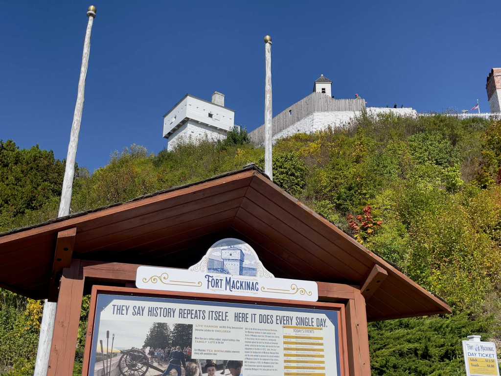
The fort was retaken by the British early in the War of 1812, and held by them until 1815. With no more issues between England and the U.S. on the northern border, the importance of Fort Mackinac declined. From 1875 to 1895, the troops did serve as park rangers for the Mackinac National Park, creating roads and footpaths through the new park. The fort was closed in 1896 by Congress and is now is a popular museum and tourist destination as one of the few fairly intact Revolutionary War forts.

Father Jacques Marquette, seen here standing guard in front of the Fort with his faithful bird companion, was a French Jesuit missionary who founded Michigan’s first European settlement, Sault Sainte Marie, and later founded Saint Ignace. Marquette, along with Louis Jolliet, was the first European to explore and map the northern portion of the Mississippi River Valley. The statue is one of three of Father Marquette; others are in the city Marquette (what a coincidence!) and the U.S. Capitol.
We greatly enjoyed our visit to Mackinac Island and the Straits. A return visit to the UP will not come as a surprise to us.
Next: Leaving Michigan, racing through Detroit and Cleveland, and stopping briefly at Presque Isle on our way to New York and Niagara Falls.
